More


 Monitoring State environmental monitoring Monitoring of water bodies The condition and mode of operation of water protection zones of water bodies Monitoring of the condition of water protection zones 2016 data
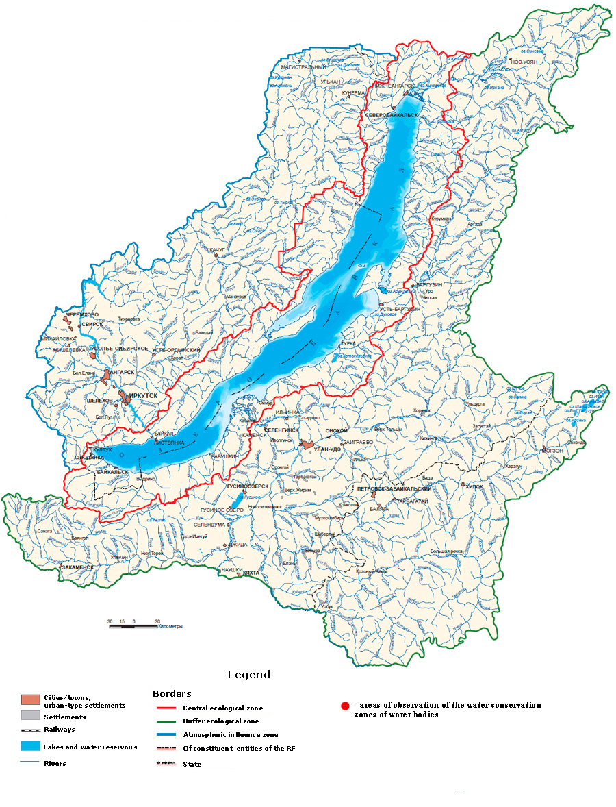
The map shows the areas of observation of the water conservation zones of water bodies.
When hovering the cursor to the place of observation, a window appears, that shows the percentages
of the area of the water protection zones, that fall in 2016 to the main types of ecosystems:
tilled areas, areas under shrubby vegetation, as well as under woody and arboreal shrub vegetation.
In 2024, the Baikal Mile will be held from 6 to 8 June.
Taking part in the Baikal Mile is a great way to test your limits of possibilities and feel the breath of nature in one of the most beautiful places on earth.
In 2024, the festival of ice sculptures on Lake Baikal is scheduled for the period from February 15 to 28. During these two weeks, the lake shore will turn into a real open-air museum, where everyone will be able to enjoy sculptural masterpieces created from ice.


The portal has been created for FSBI ”Informational and Analytical Center for Development of Water Bodies and Associated Properties” under the special program “Protection of Lake Baikal and Socio-Economic Development of the Baikal Natural Preserve for 2012-2020.”
